2. The Cairngorms
The Cairngorms are located in the Highlands of Scotland (Figure 1.),
between the towns of Aviemore in the Spey Valley and Braemar. The mountain range is an important conservation area,
quite understandably as it is the largest area of high land in the country and one of the best areas of sub-Arctic
land in Europe outside Scandinavia. In Scotland, this plateau is the only natural area left that has been unaltered
by humans. Shaped by glaciers the Cairngorm plateau contains four of the five tallest mountains in Britain, including
Ben Macdui which, at 1309m (4295ft) is the second highest.
As a northern landscape in the middle of Scotland the plateau is an important area of nature
conservation, consequently the government is seeking to acquire World Heritage Site status. The hills are home
for many rare plants, birds, and mammals and in the surrounding area there is extensive forest, including the remains
of the historic Caledonian pine forest. Due to the climate on the plateau the vegetation tends to consist of alpine
grass and heather, whilst much of the highest land is bare rock. The limited vegetation restricts wildlife diversity,
but much of the wildlife that does exist is unique in this country. "Nearly a third of the UK dotterel population
breed here, as do three per cent of our golden eagles, and over half of the snow bunting, a bird more associated
with the sub-Arctic" (WWF 1998). To reflect this importance a large part has been proposed as a Special Protection
Area under the EC Birds Directive.
The Cairngorms are not a National Park as recommended by the 1945 Ramsey report and debate
has raged ever since as to the protection status provided. Over 220 square miles have been declared Sites of Special
Scientific Interest (SSSI), and recently parts have been designated as Special Protection Areas (SPA) and Special
Areas of Conservation (SAC) under EC Directives, although this designation is rather contentious. The new Labour
government has announced "that it considers National Parks appropriate for some areas of Scotland and
it is widely expected that the Cairngorms will be one of the earliest designated" (The Cairngorms Campaign
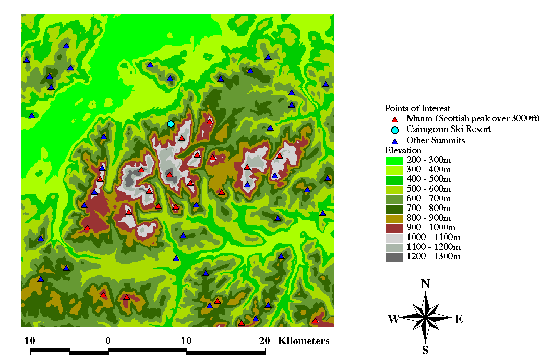
1997). Figures 2a & 2b provide a visual image of the Cairngorms whilst
Figures 3 & 4 are included to supply elevation and topography information
for the study area.
NOT YET AVAILABLE
Figures 2 a & b. Photographs of the Cairngorms
NOT YET AVAILABLE
NOT YET AVAILABLE
(Source: Views from Scottish Mountains)
Figure 3. Study Area Topography
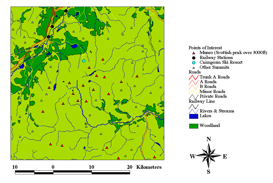
Figure 4. Study Region Elevation
Last Modified 22-03-99