Locating an Observation Tower in the
Grampian Mountains
John J. Bark
- Introduction
- Methodology
- Visibility
- Accessibility
- Topography
- Geomorphology
- Selecting an Optimal Location
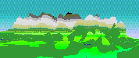
- Simulated View from the Observation Tower
- Conclusions
- Bibliography
- Surface Features within the Region
- Contour Map of the Region
- Areas 50 Metres above Ground Level Visible from the Castle
- Areas 50 Metres above Ground Level Visible from the Munro
- Areas 50 Metres above Ground Level Visible from the Ski Slope
- Summits Visible from Areas 50 Metres above Ground Level
- Location Suitability depending upon Visibility
- Buffer Regions around the A Roads
- Buffer Regions around the Railway Stations
- Location Suitability depending upon Accessibility
- Location Suitability depending upon Topography
- Elevation Map
- Angle of Slope Map
- Location Suitability depending upon Geomorphology
- Selecting the Optimal Location
- Location Suitability Map
- Landscape Features Visible from the Observation Tower
- Elevation Visible from the Observation Tower
- The Southeast View from the Observation Tower
- The Northeast View from the Observation Tower
- The Location Criteria
- The Ten Data Layers Produced
- Other Peak Visibility Reclass Values
- Accessibility Reclass Values
- Elevation Reclass Values
- Angle of Slope Reclass Values
