5. Representing Terrain Surfaces within GIS
Perceived as a continuous surface, the landform can not be modelled by choropleth maps. Contour
lines are the most common method of representing this continually varying surface. Unfortunately, although ideal
for displaying the surface, they are not especially suitable for numerical analysis or modelling. Consequently
"other methods have been developed to represent and use effectively information about the continuous variation
of an attribute (usually altitude) over space" (Burrough 1986).
Digital terrain models (DTM) represent a continuous variable over a two-dimensional surface
by a regular matrix of z values and are generally used to represent relief. They are also known as digital elevation
models (DEM) and by other names but for continuity purposes this work will only refer to them as DTMs. Although
used in geo-scientific applications since the 1950s (Weibel & Heller 1991) it is only in the past decade that
DTM usage has become commonplace for modelling and analysing terrain data.
Through various analytical operations DTMs allow the calculation of a wide range of variables,
including those contained in Table 2. These are used in a variety of applications, ranging from civil engineering
and military applications to planning and resource management.
Table 2. Products Derived From DTMs
· Geomorphometric Analysis
· Block diagrams, profiles and horizons
· Volume estimation
· Contour maps
· line of sight maps
· Shaded relief maps
· Drainage network and drainage basin delineation
(Source: Burrough 1986 & Weibel & Heller 1991)
5.1 Data Sources For DTMs
DTM data should consist of observations about terrain elevations and wherever possible, additional
information about the phenomena that influences the shape of the surface (Weibel & Heller 1991). Most DTM data
is derived using three alternate sources: ground surveys, photogrammetric data capture, or from digitised cartographic
data sources. Ground survey data is highly accurate but is time consuming and expensive to collect, thus it tends
to be applied to specific, small-scale projects. Photogrammetric data is derived through stereoscopic interpretation
of aerial photographs or satellite imagery, using specialist photogrammetric equipment. Depending upon the sampling
method and image used the accuracy of the resulting DTM will be medium to high, and since no fieldwork is required
large areas can be dealt with in a relatively short period (Weibel & Heller 1991).
The cheapest procedure is to derive the data from existing cartographic sources, such as
maps through manual digitising or automatic raster scanning and vectorisation. This indirect procedure is used
for large-scale data collection by national or military mapping agencies due to the large volume of paper maps
that exist. As the most common form of terrain representation, contours are a ready source of data as they already
exist on most maps and can be captured automatically using high quality scanners. Despite their widespread use,
using contour data as the basis for DTMs has disadvantages. It is argued that digitising existing contours produces
lower quality DTMs than direct photogrammetric measurements. They also suffer from data 'oversampling' along the
lines whilst no data is sampled between them, and generalisation errors can occur in the map making process (Weibel
& Heller 1991). Therefore, they are not especially suitable for calculating geomorphological variables or even
creating shaded relief models. As the data is of limited accuracy the contours are often converted to a point model
such as the discrete altitude matrix (Burrough 1986).
5.2 Methods of Representing DTMs
A variety of data structures have been used for DTM construction, but the majority conform
to one of two data structures, the discrete altitude matrix (Grid) or the Triangulated Irregular Network (TIN).
Of these the altitude matrix or grid is the most common, which records the topological relationships
between data points. As this data structure reflects the storage structure of computers "the handling of elevation
matrices is simple, and grid-based terrain modelling algorithms thus tend to be relatively straightforward"
(Weibel & Heller 1991). Due to this ease in data handling the grid structure has become the most widely available
form of DTM in Britain and the USA.
Grids are useful for calculating contours, slope angles and aspects, hill shading and geomorphological
analysis but suffer from a number of disadvantages. The principal problem is the storage method results in a considerable
amount of data redundancy because in areas of more complex terrain, such as ridges or peaks a high number of grid
cells is required to represent these important landscape features accurately. As the cell size remains equal across
the DTM in areas of less complex terrain the small cell size records data that is not required. However, if the
cell size is enlarged it can become too coarse to accurately represent detailed landscape features. Ideally the
data points would be closely spaced in terrain that is more complex and sparsely distributed over more level areas.
This misrepresentation problem could lead to difficulties performing quantitative geomorphometric analysis (Burrough
1986). In spite of this issue the altitude matrix remains the most easily obtainable form of DTM, but the TIN data
structure has been developed to help address these problems.
Designed in the 1970s the Triangulated Irregular Network (TIN) model for DTMs was designed
to avoid "the redundancies of the altitude matrix and which at the same time would also be more efficient
for many types of computation (such as slope) than systems that are based only on digitised contours" (Burrough
1986). The TIN terrain model is created from continuous, connected triangular facets based on the Delaunay triangulation
procedure for irregular spaced observation points. Unlike a regularly spaced grid the TIN structure allows the
collection of extra data in areas of complex terrain without collecting large quantities of redundant data in areas
of simple terrain. Therefore a TIN can capture important features such as a ridge or a stream line to the accuracy
required by the user and the co-ordinate positions and the point elevations that form the triangle vertices are
used to calculate surface characteristics. However as each topological relationship is computed the TIN is more
complex and difficult to handle, and as yet not all grid based algorithms have an effective counterpart for TIN
structures (Weibel & Heller 1991). Although it has been demonstrated that TINs can be used to generate maps
representing slope, shaded relief, contours, profiles horizons and line of sight, the final images retain an imprint
of the Delaunay triangulation (Burrough 1986). Overlaying and intersecting the TIN structure with the topological
polygon structures that used to represent their values can also incorporate surface information.
Whilst both data structures have advantages and disadvantages it is important to state that
"no data structure is clearly superior for all tasks of digital terrain modelling" (Weibel & Heller
1991). It is also important to note that neither DTM represent method is completely accurate, thus DTM vendors
often produce a root-mean-squared error (RMSE) for each DTM tile. "The error may be caused by faulty equipment,
fluctuating power supply, precision of the data format, poor interpolation or human problems" (Fisher 1991)
and reproduces itself into the derivative products that result from GIS operation on the DTM. The error effect
on visibility analysis is discussed in section 6.3.
5.3 The Digital Terrain Data Used
The DTM data used in this analysis originates from EDX Engineering, USA, who possess digital
elevation data for the whole of the United Kingdom. They digitised 1:63,360 scale topographical maps published
before 1942 for which the Ordnance Survey (OS) copyright has expired. The resulting vector data was converted to
a uniform grid (DTM) of elevation points with 50 metre spacing from which a new contour map was produced and compared
with modern 1:50,000 OS maps. If any substantial differences were discovered the original 1:63,360 maps were re-digitised
and through repeating this process EDX has ensured that 99% of the elevation points in their terrain data are within
20 metres of the corresponding elevation on the modern OS maps. This results in a RMSE of less than 2.5 meters.
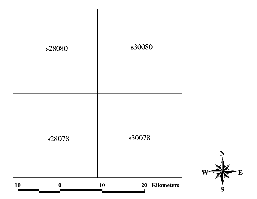
Each data-file or grid tile covers an area of 20km by 20km, divided into 50 metre cells.
Four such tiles as illustrated in Figure 6 cover the Cairngorms. As individual tiles their use was limited and
consequently they needed linking together. Most proprietary GIS packages, including Arc/Info allow DTMs to be combined
either by joining adjacent models or by merging overlapping models. For grid DTMs joining is only straightforward
if they correspond in grid resolution, orientation, etc., otherwise 'resampling' is required to establish continuity.
Additionally, merging DTMs can pose problems when the data is of conflicting attributes (elevation and gradients)
with varying degrees of accuracy but fortunately, as all the terrain data used originated from EDX these problems
were not met.
Figure 6. The EDX Data Tiles used to cover the Cairngorms
Last Updated 22-03-99